Oceanographic Characteristics
"The Sargasso Sea is...within a large ocean gyre bounded by major currents that concentrate Sargassum and pollutants and has characteristic eddies and fronts that impact productivity and biodiversity. Beneath the gyre water depths vary down to around 4500 m, and the seabed features both abyssal plains and shallow seamounts."
"The Sargasso Sea lies within the sub-tropical North Atlantic gyre; such gyres cover ca 65% of the ocean surface. The encircling currents of the Sargasso Sea (FiguRe 1) trap water at the core of the Sargasso Sea for estimated periods of up to ca 50 years (Maximenko, Hafner and Niller 2011) and concentrate Sargassum, plastics and other pollutants.
The environment of the Sargasso Sea is further influenced by rings and eddies that may persist as distinct entities for many months (McGillicuddy, Johnson, Siegel, Michaels, Bates and Knap 1999). Figure 17 shows Gulf Stream rings trapping cold shelf water (green blobs) that have moved into the Sargasso and conversely a warm water ring (red ring off New York) that has trapped water from the Sargasso Sea. The ‘cold water rings’ (Richardson, Cheney and Worthington 1978) have a cyclonic circulation and can persist for years (Cornillion, Evans and Large 1986). In contrast warm core rings have an anticyclonic circulation that transports Sargasso Sea water westwards where they eventually coalesce into the Gulf Stream. In addition to these rings there are smaller mode water eddies-lenses of uniform water density that form in midwater and rotate in an anticyclonic direction beneath the surface. These features are collectively referred to as mesoscale eddies—having diameters ranging from tens to hundreds of kilometers and the different types of eddies create localised upwelling and downwelling and impact the upper layers of the Sargasso Sea by mixing surface and deeper waters. This affects nutrients, heat and salinity which together create localised areas of high productivity (Volk and Hoffert 1985, Glover, Doney, Mariano, Evans and McCue 2002, Benitez-Nelson and McGillicuddy 2008) or low productivity (MaurinoCarballido and McGillicuddy 2006). They also impact the biodiversity by bringing ‘foreign species’ into the area whose relic populations may persist for months or conversely by spinning species out into the Gulf Stream (Boyd, Wiebe and Cox 1978, Wiebe and Boyd 1978, Ring Group 1981).
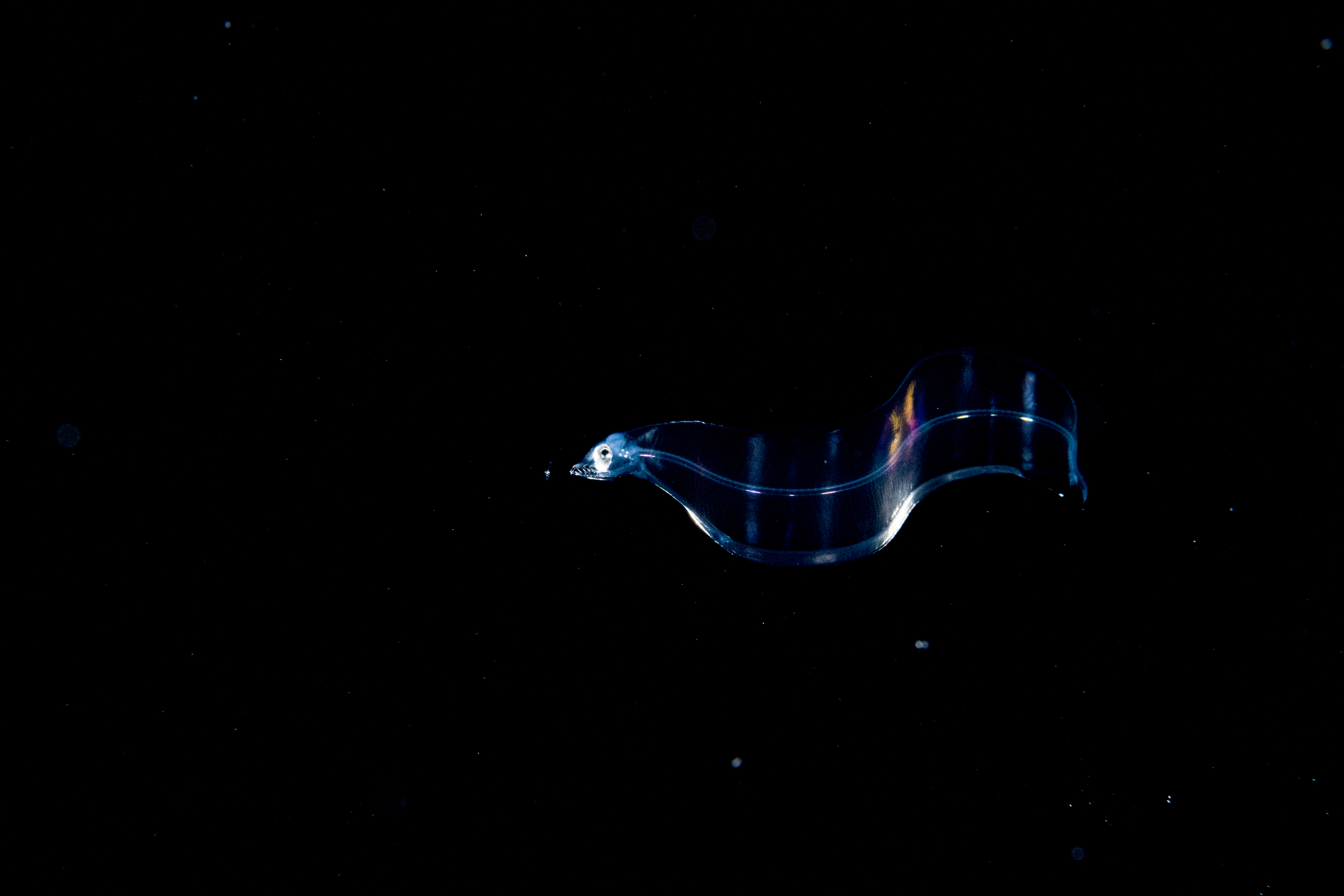 Eel larva - photo courtesy of Greenpeace, Shane GrossAnother important feature of the western Sargasso Sea is the Subtropical Convergence Zone (STCZ, 20o- 30oN) where warm and cold water masses meet and create distinct temperature fronts in the upper 150 m of the ocean in the fall to spring seasons (Katz 1969, Weller 1991). Two or three bands of these fronts form each year and are a dynamic seasonal feature of the Sargasso Sea. Water converges from both sides into these fronts causing strong frontal jets or eastward counter currents to form (Mied, Shen, Trump and Lindemann 1986, Eriksen, Weller, Rudnick, Pollard and Regier 1991, Weller, Rudnick, Eriksen, Polzin, Oakey, Toole, Schmitt and Pollard 1991, Pollard and Regier 1992). Because of this convergence, Sargassum weed accumulates at the surface of the fronts forming large rafts of weed. Other organisms also accumulate there, so the fronts are likely important feeding areas for predatory fishes and marine mammals in the Sargasso Sea. These fronts also form zoogeographic boundaries between the distributions of pelagic fishes (Backus, Craddock, Haedrich and Shores 1969) and of anguillid and marine eel larvae (Miller and McCleave 1994), and the associated frontal jets appear to transport some leptocephali and presumably many other organisms eastward further offshore into the Sargasso Sea (Miller and McCleave 1994). As the surface waters of the STCZ get warmer in the late spring and summer the frontal zones move further north (Ullman, Cornillon and Shan 2007).
...[B]eneath the Sargassum layer, the Sargasso Sea descends to depths of around 4500 m and is populated throughout by deep ocean animals. Sargassum, once it sinks, contributes to the food webs of these deepwater communities and provides up to 10% of the energy inputs to communities living on the sea-floor (Schoener and Rowe 1970, Rowe and Staresinic 1979—in Angel and Boxshall 1990, Butler et al 1983). ...
Despite the apparent overall similarity between the midwater communities in the Sargasso Sea and elsewhere, more detailed studies show that there might be subtle differences in species composition and distribution. Porteiro (2005) found a suite of sub-tropical endemic deep-sea fish species in the northern Sargasso Sea within the Stomiatoid genera Eustomias, Photonectes and Bathyphilus and concluded that the area had higher levels of endemicity for this group than in other north Atlantic biogeographic provinces. It is worth noting that Angel (2010) in drawing up an inventory of planktonic ostracods for the Atlantic ocean observed that 10% of the species caught below 2000 m were new to science and that if the sampling had reached the benthopelagic zone within a few metres of the sea-bed the novel component would have soared. Both stomiatoid fish and ostracods are likely to be an indicator of how little is known about the midwater inhabitants living at great depths.
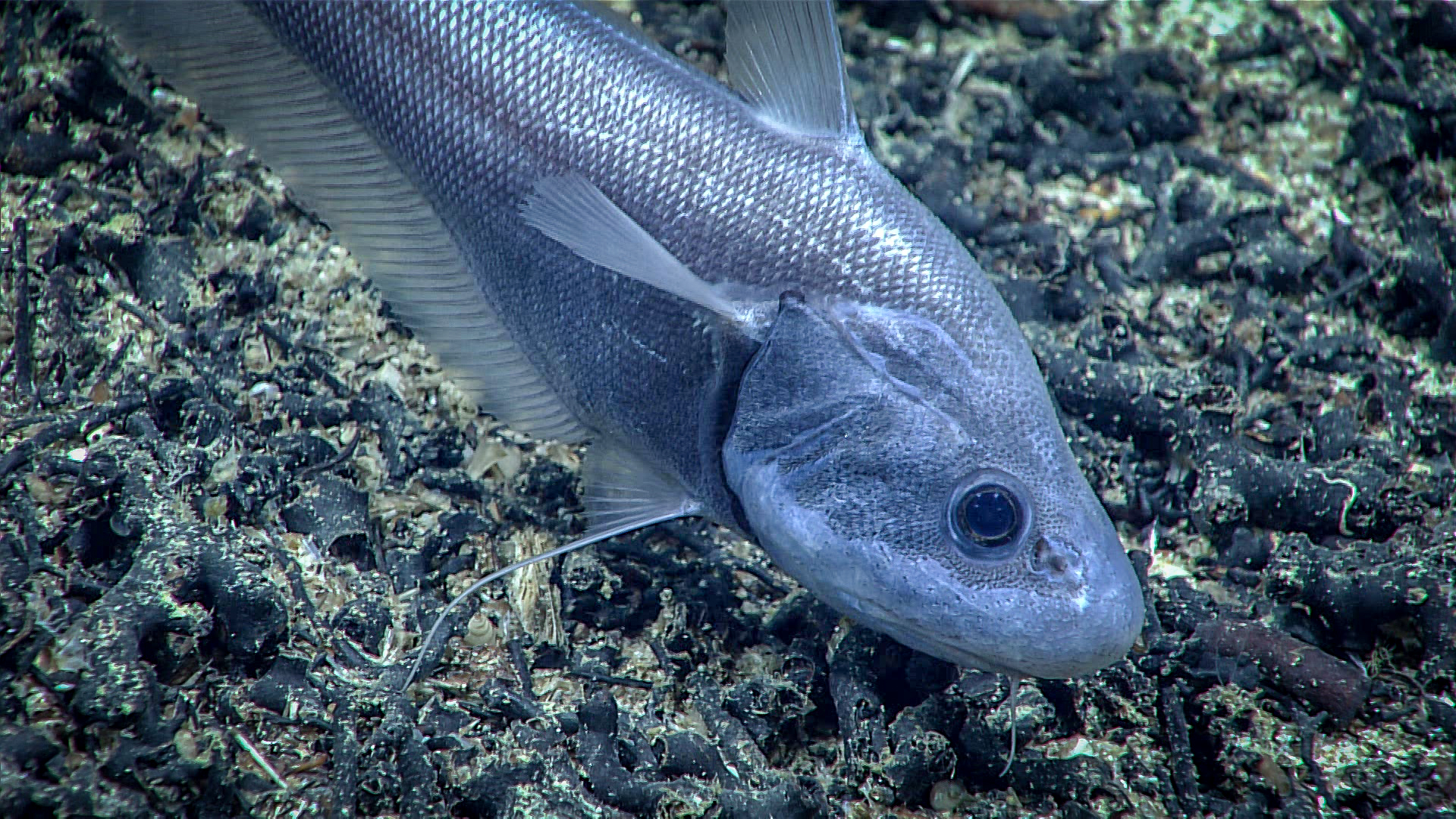 Photo credit: NOAA Okeanos Explorer 2021 North Atlantic Stepping Stones The seabed and underlying geology of the Sargasso Sea reflects the evolution of the ocean basin floor over a period of approximately 150 million years. The bathymetry from west to east passes from the continental rise of the North American continental margin at around 2000 m water depth, descends gently into parts of the Hatteras, Nares and Sohm abyssal plains, with depths reaching over 4500 m, before shallowing progressively towards the Mid Atlantic Ridge where the water depth is less than 2500 m. This regional relief is modified dramatically by extinct volcanoes that form the Bermuda Islands, seamounts and associated Bermuda Rise, and the New England and Corner Rise Seamount chains further north. Several major fracture zones, the Atlantis, Northern, Kane and Blake Spur cross the area. The entire region is underlain by igneous oceanic crust formed at the Mid-Atlantic Ridge, which is covered by sediments formed by pelagic deposition and turbidity currents from the USA continental margin of the USA east coast and Bermuda. (See e.g. Detrick, White and Purdy 1993, Uchupi, Phillips and Prada 1970, Voygt and Jung 2007, Dlvens 2011, Parson and Edwards 2011, unpublished) Potential mineral resources in the area include polymetallic sulphides, manganese nodules and cobalt-rich crust, hydrocarbons and gas hydrates (see Section 9).
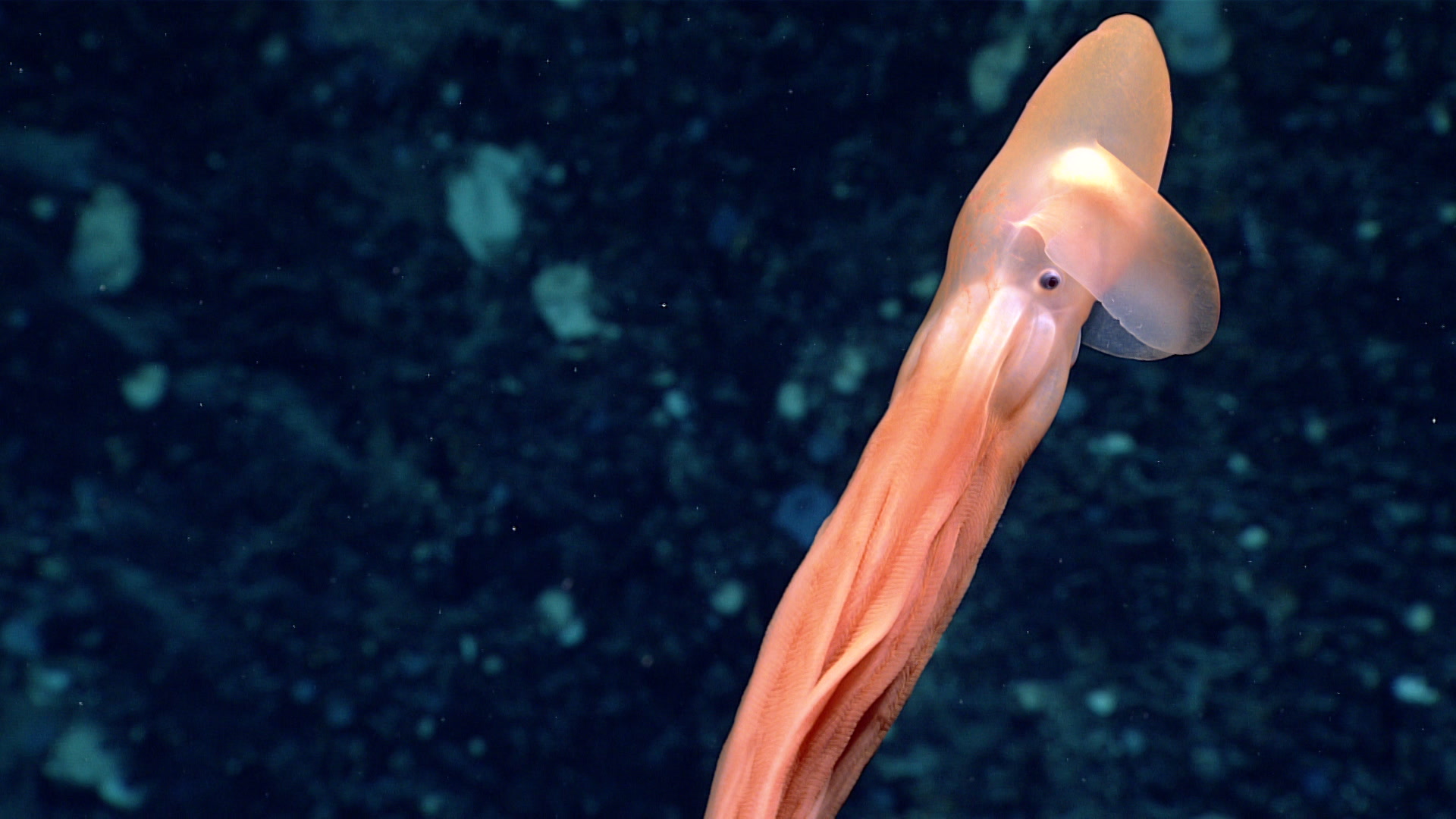 A dumbo octopus. Photo credit: NOAA Okeanos Explorer 2021 North Atlantic Stepping Stones The biology of the abyssal plains is best known through work done on a repeated transect between Bermuda and Gay Head in the USA in the 1960s and 70s (Sanders, Hessler and Hampson 1965)—work that remains a milestone in our knowledge of deep-ocean bottom faunas. Very recently a new observational programme on the larger bottom fauna has started using baited cameras (MBARI Sargasso Sea Expedition 2011 www.mbari.org). The seamounts increase significantly the biodiversity of the bottom fauna, and as elsewhere in the world ocean such features provide a haven for marine life but have been extensively damaged by destructive benthic trawling (Watling, Waller and Auster 2007, Shank 2010). Deepsea and seamount fish stocks are particularly vulnerable to exploitation because the fish are very long lived, take many years to reach sexual maturity, and have very low fecundities (Norse, Brooke, Cheung, Clark, Ekeland, Froese, Gjerde, Haedrich, Heppell, Morato, Morgan, Pauly, Sumaila and Watson 2012).
 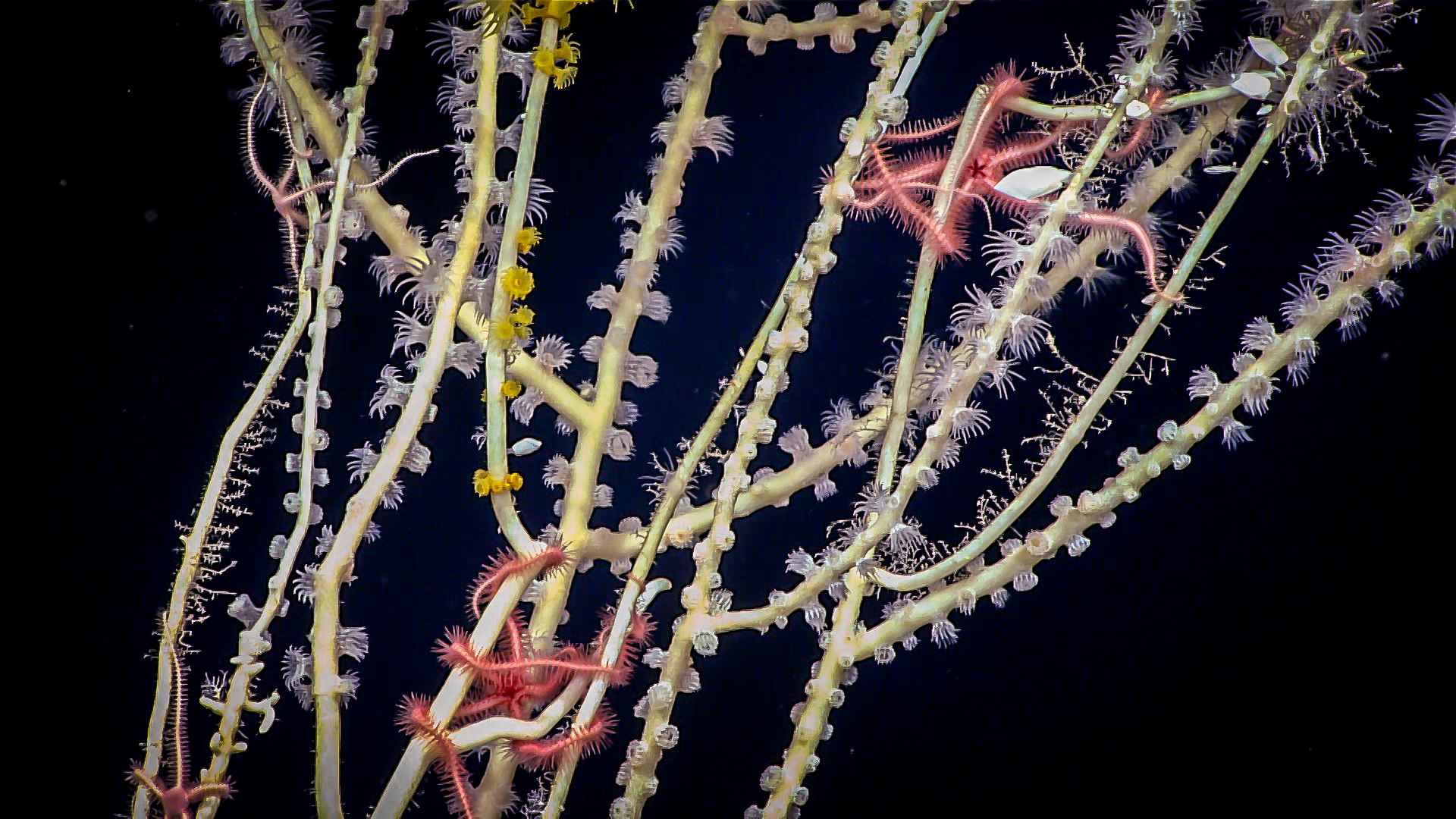 Photo credit: NOAA Okeanos Explorer 2021 North Atlantic Stepping Stones
In the open ocean the best known seamounts in the area are the New England Seamount chain and the Corner Rise Seamounts. The latter have peaks rising as much as 4000 m from the abyssal plain and support complex coral and sponge communities that provide habitat for diverse invertebrate and fish species, many of which are endemic. Benthic diversity is very high on the Corner Rise and New England Seamount chains where some 670 species have been found including numerous endemic and new species of corals which in turn host specific commensal invertebrates (Watling 2007, Watling et al 2007, Cho 2008, Shank 2010, Simpson and Watling 2011, Pante and Watling 2011, ICES 2011). These seamounts also host abundant populations of deep-water fish, which have been heavily exploited commercially since 1976 (Vinnichenko 1997), but despite this they remain important as aggregating and spawning areas for the alfonsino (Beryx decadactylus). "
Laffoley, D.d’A., Roe, H.S.J., Angel, M.V., Ardron, J., Bates, N.R, Boyd, I.L., Brooke, S., Buck, K.N., Carlson, C.A., Causey, B., Conte, M.H., Christiansen, S., Cleary, J., Donnelly, J., Earle, S.A., Edwards, R., Gjerde, K.M., Giovannoni, S.J., Gulick, S., Gollock, M., Hallett, J., Halpin, P., Hanel, R., Hemphill, A., Johnson, R.J., Knap, A.H., Lomas, M.W., McKenna, S.A., Miller, M.J., Miller, P.I., Ming, F.W., Moffitt, R., Nelson, N.B., Parson, L., Peters, A.J., Pitt, J., Rouja, P., Roberts, J., Roberts, J., Seigel, D.A., Siuda, A.N.S., Steinberg, D.K., Stevenson, A., Sumaila, V.R., Swartz, W., Thorrold, S., Trott, T.M., and V. Vats. 2011. The protection and management of the Sargasso Sea: The golden floating rainforest of the Atlantic Ocean. Summary Science and Supporting Evidence Case.Sargasso Sea Alliance, 44 pp. Click here to download full report PDF which includes figures mentioned above.